The GIStorical Antwerp team provided a series of maps for the Atlas of Antwerp. The GIStorical Antwerp team consists/consisted of Prof. dr. Tim Soens, Prof. dr. Iason Jongepier, Dr. Rogier van Kooten, Ric Janssens, Dr. Léa Hermenault, Jesse van Schijndel, Afra de Mars, Eloi Vincendet, Mark Lathouwers and Ewa Kaźmierczyk, of which several persons contributed to the atlas. Gerrit Vroon assisted in final lay-outing.
- Move through the carroussel and click on the images to see a HR version
- Image use is only permitted when making reference to "GIStorical Antwerp, University of Antwerp, Centre for Urban History
The Historical Atlas is available in Dutch via publisher Thoth

Maps from the Historical Atlas
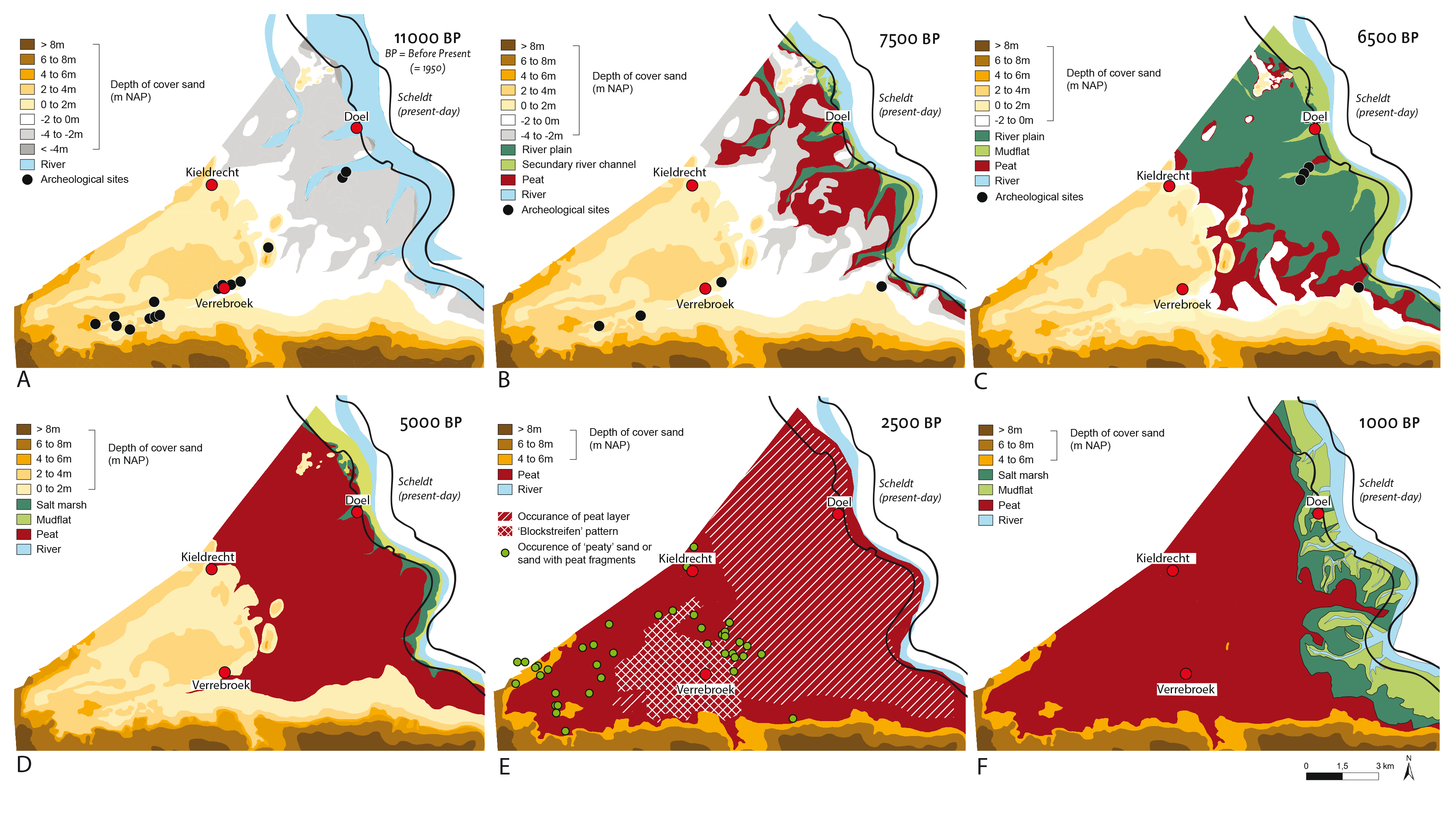
Chapter 1 - The palaeography of the area on the left bank of the Scheldt north of Antwerp between the end of the last Ice-Age and 1000 AD
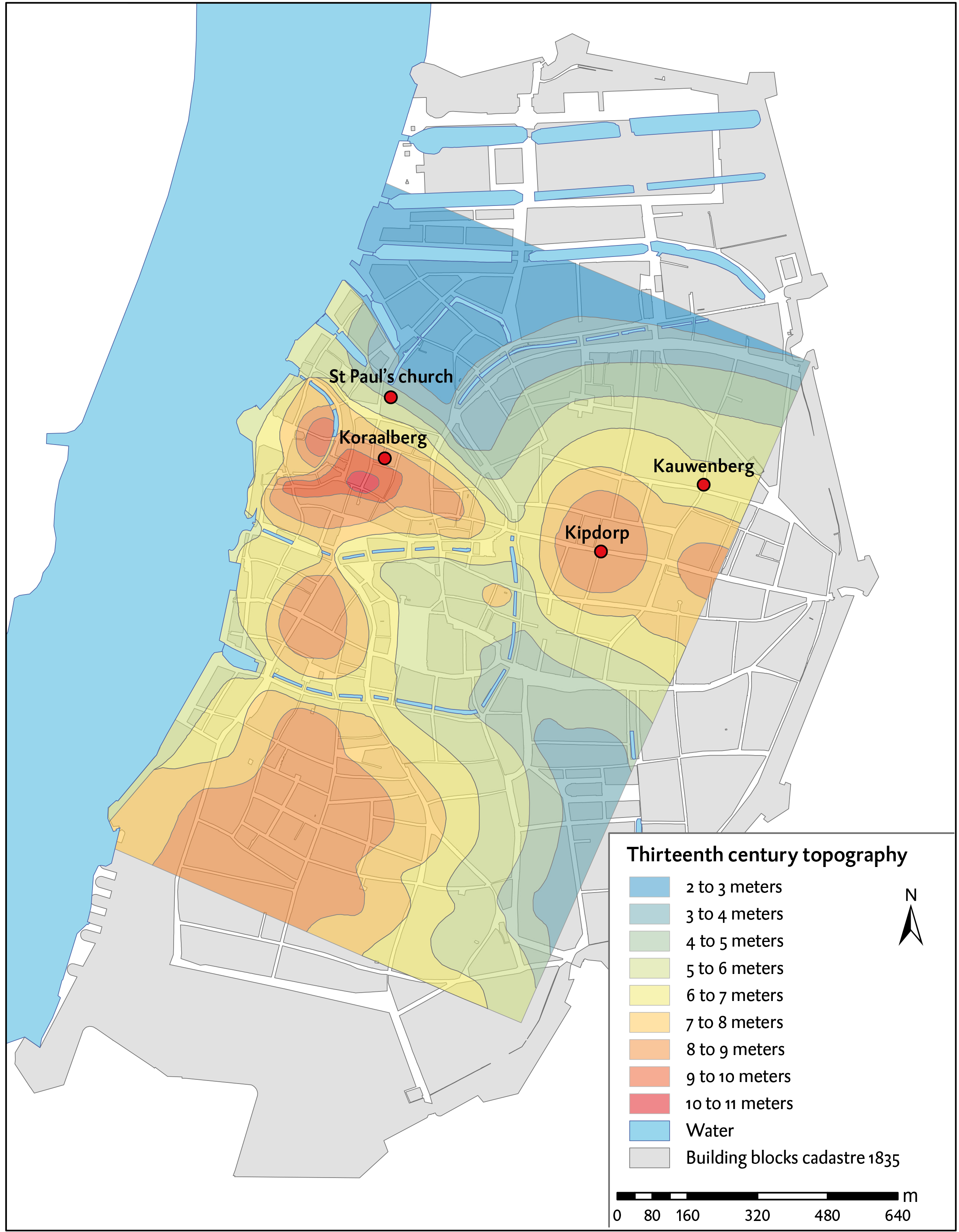
Chapter 1 - Reconstruction of the sand ridges and varying height levels in the centre of Antwerp
Chapter 3 - Modern reconstruction of the medieval and sixteenth century enlargements
Chapter 6 - Analysis showing the location of potentially polluting professions in 1584
Chapter 8 - Gilbert Van Schoonbeke’s most important projects in Antwerp’s inner city

Chapter 8 - Tax records for 1584 and 1585 show the presence of clear religious segregation in the city

Chapter 12 - Exodus from the city after 1585
Chapter 12 - Fortifications North of Antwerp
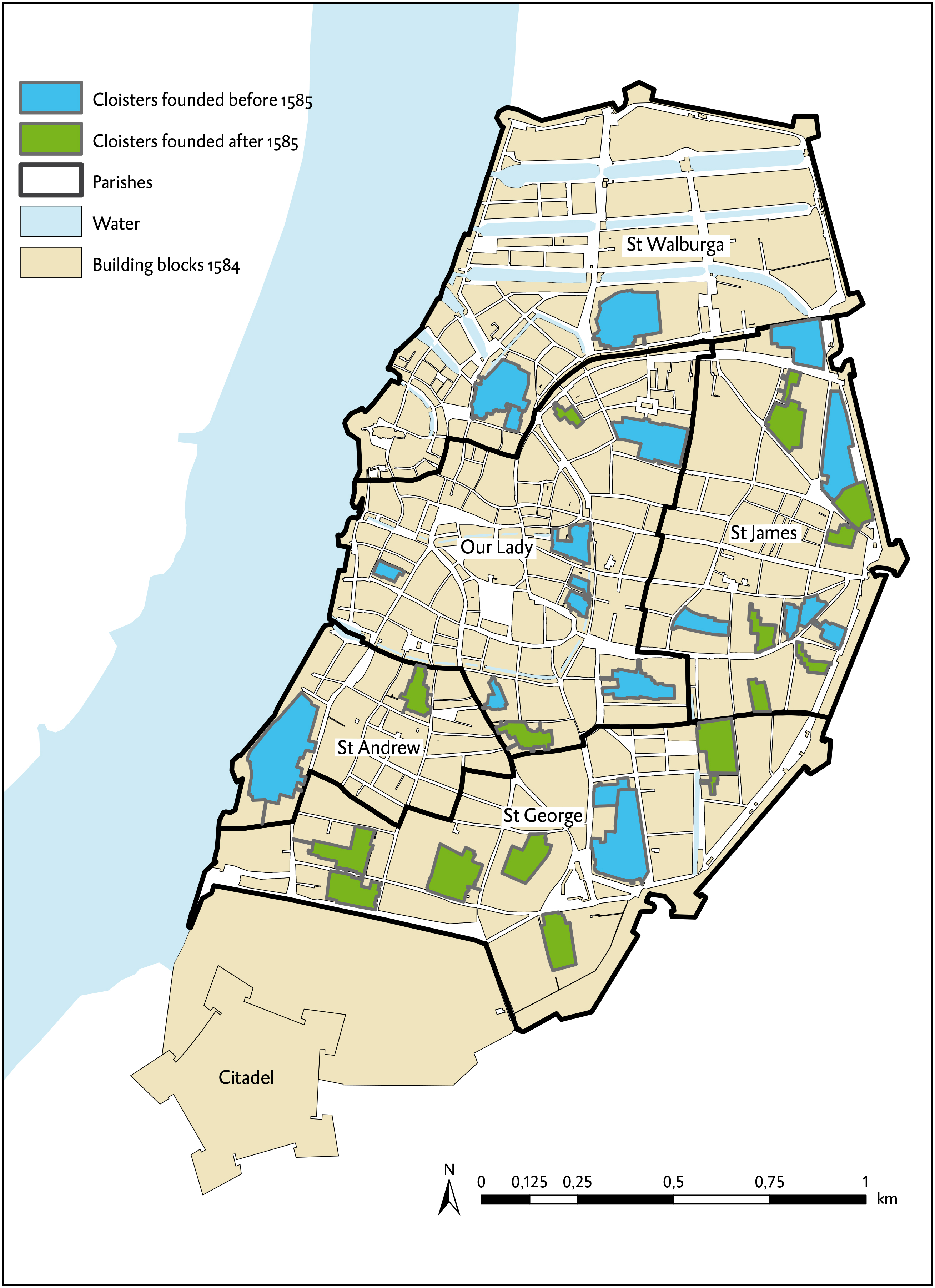
Chapter 13 - Reconstruction map of the location of the convent grounds in the five Antwerp parishes
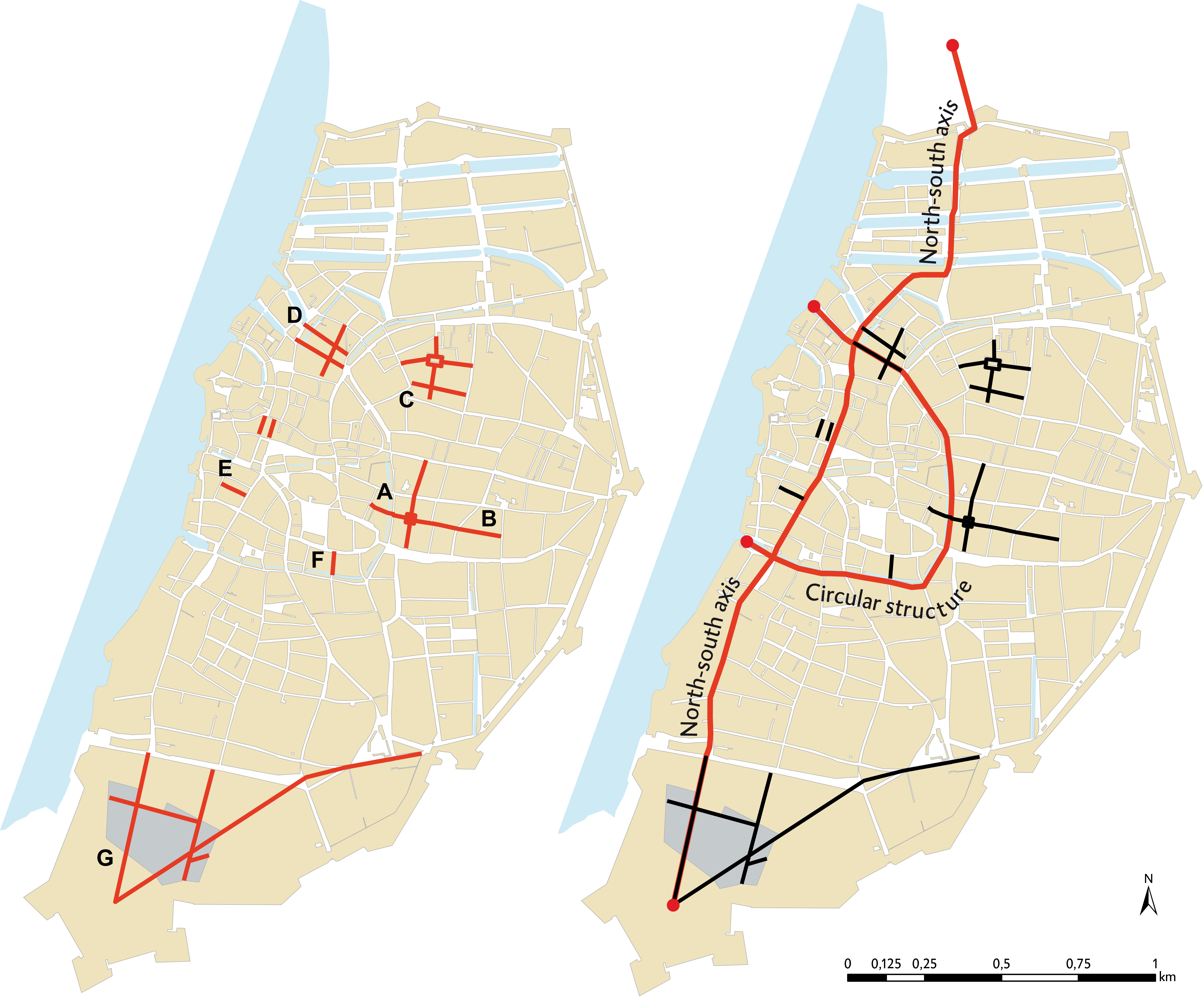
Chapter 13 - The planned urban interventions of the Calvinist Republic (1582-1584)
Chapter 14 - The route taken by Cardinal-infant Ferdinand through Antwerp in 1635

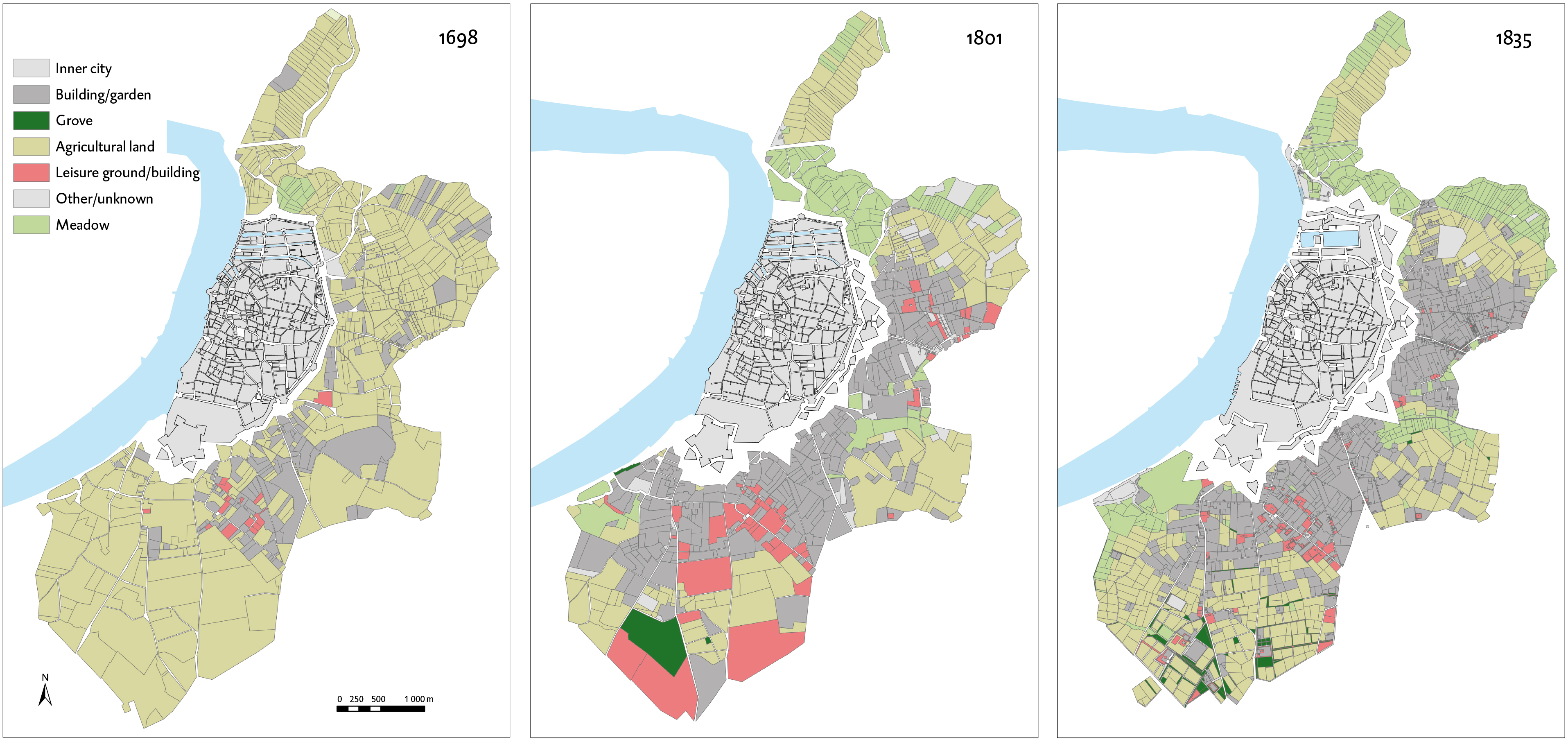
Chapter 15 - Reconstruction maps of rural retreats in 1698, 1801 and 1830

Chapter 16 - Reconstruction maps of land use of the buitenijen (outlying areas) around the city in 1698
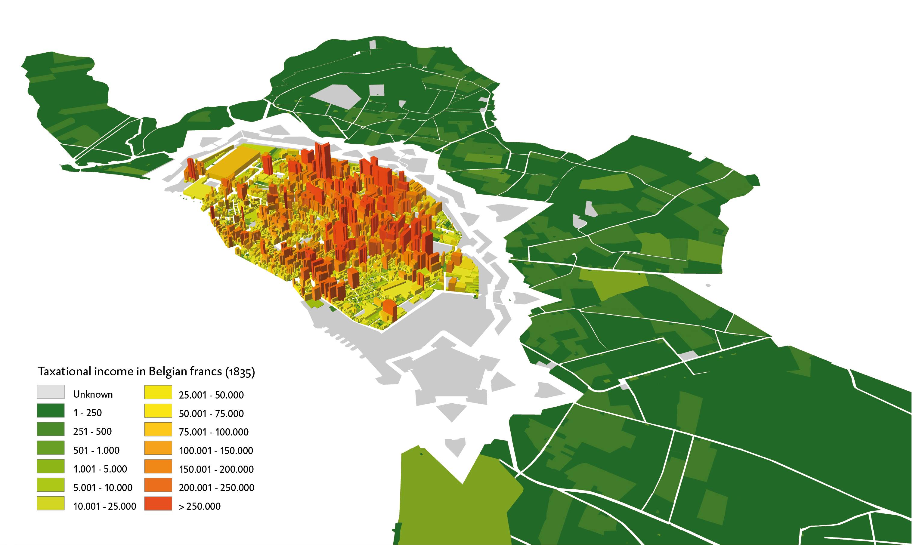
Chapter 19 - Map showing taxable income for the inner city
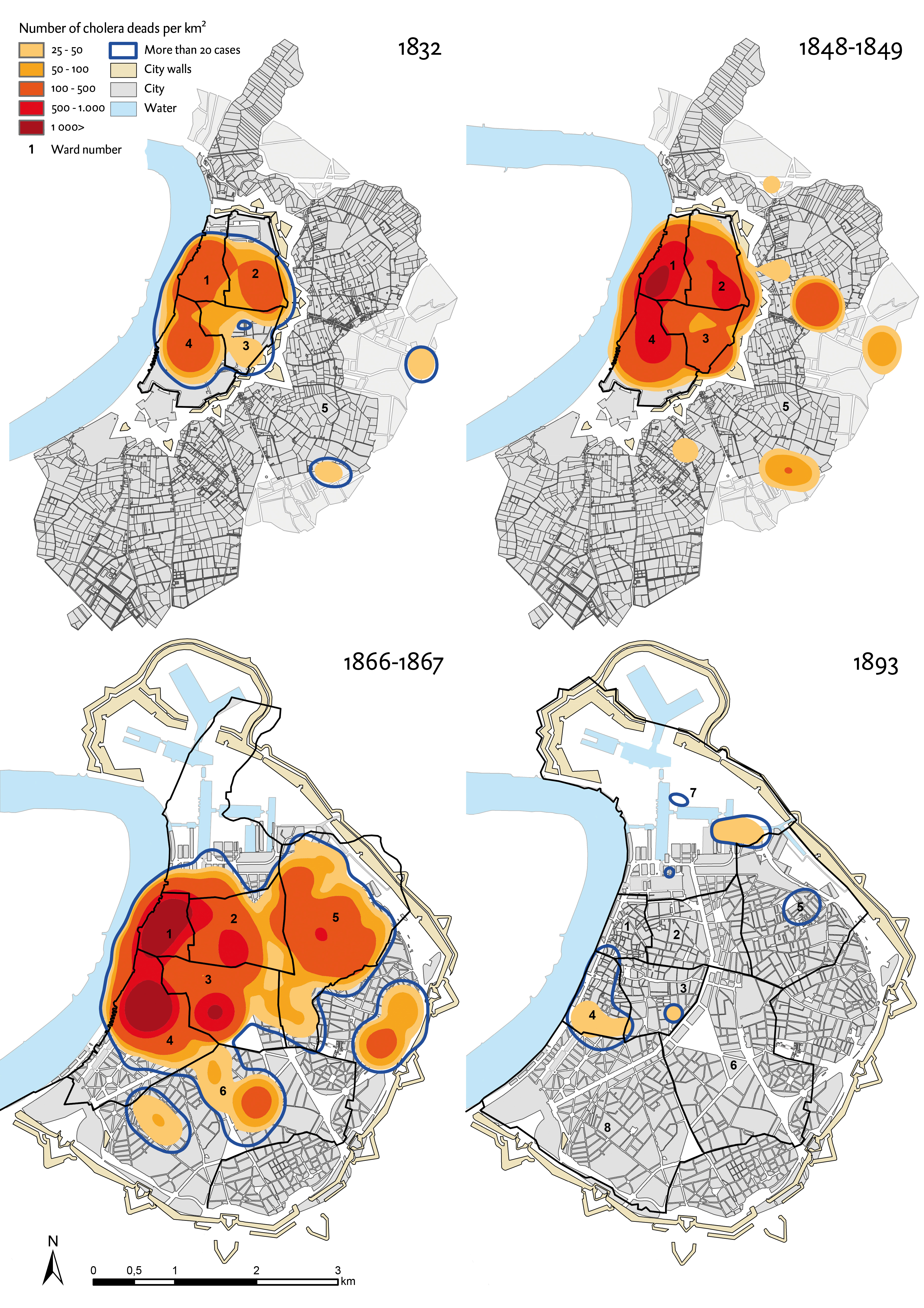
Chapter 21 - Spread of cholera epidemics for the years 1832, 1848/1849, 1866/1867 and 1893
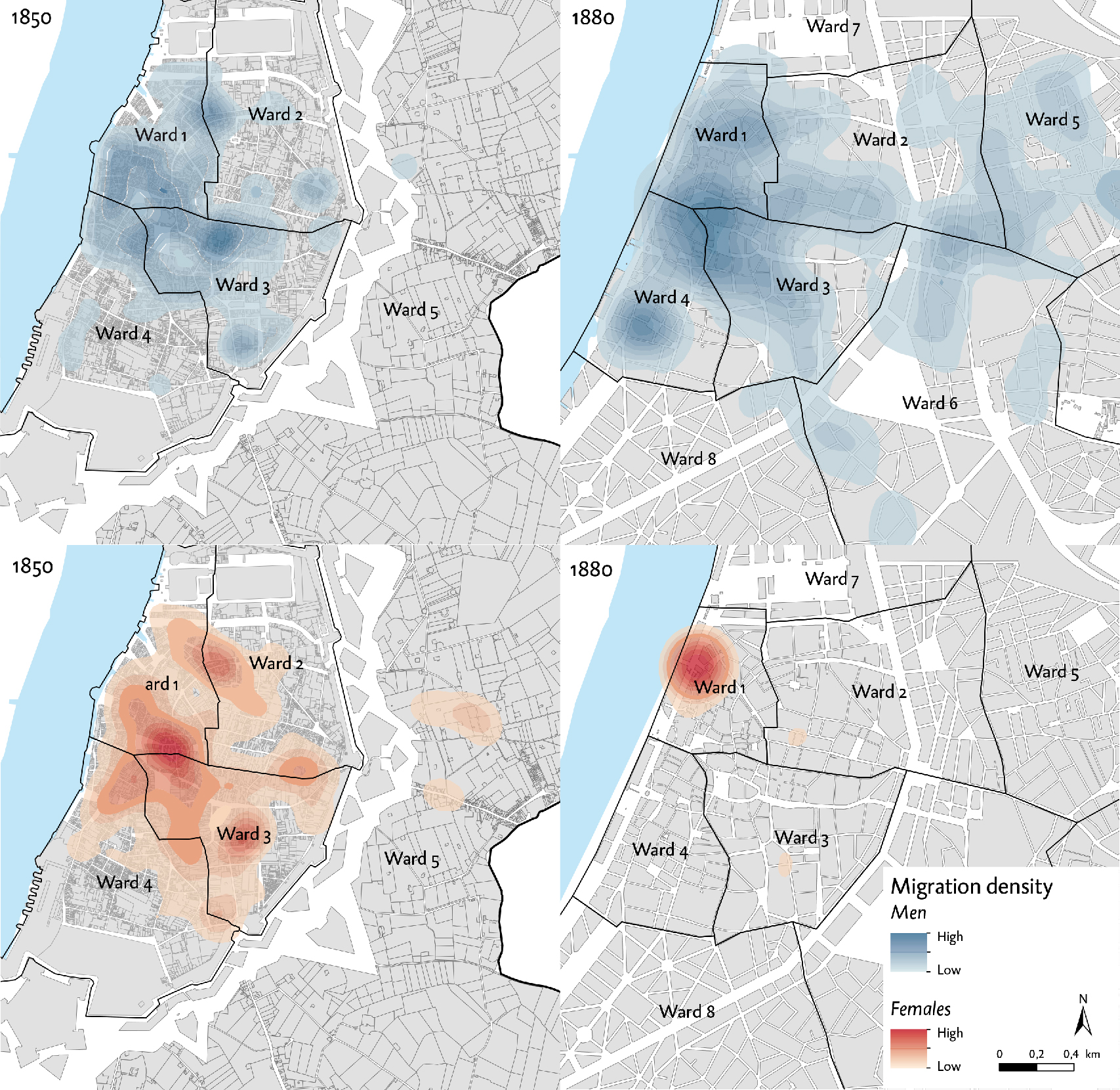
Chapter 23 - Comparison of the settlement patterns of foreign newcomers in 1850 and 1880, before and after demolition of the ramparts
Chapter 24 - Housing units before and after the straightening of the Scheldt quays

Chapter 28 - Expansion of the dock infrastructure on the right bank of the Scheldt between 1800 and 1950, from the Eilandje (Islet) northwards

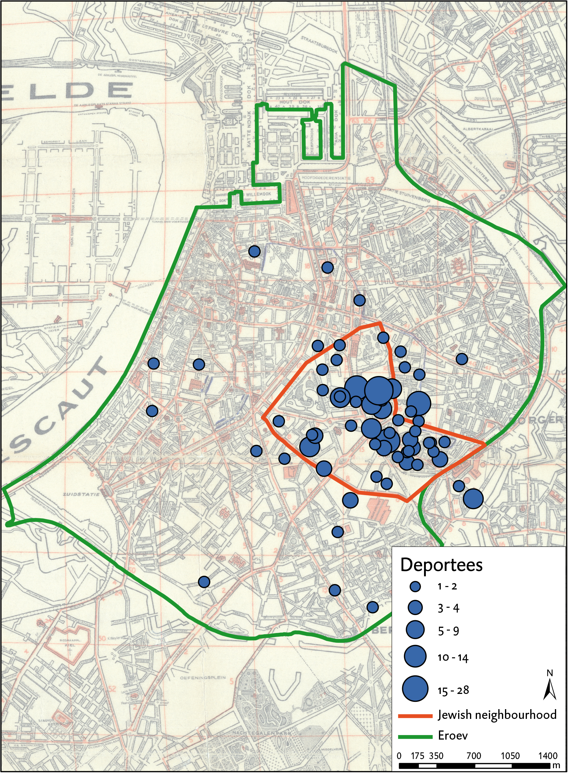
Chapter 30 - Reconstruction map of deported Jews in 1942 on the basis of Van Goethem & Van den Dalen
Chapter 30 - Density analysis of V1- and V2-bombs dropped on Antwerp and surroundings

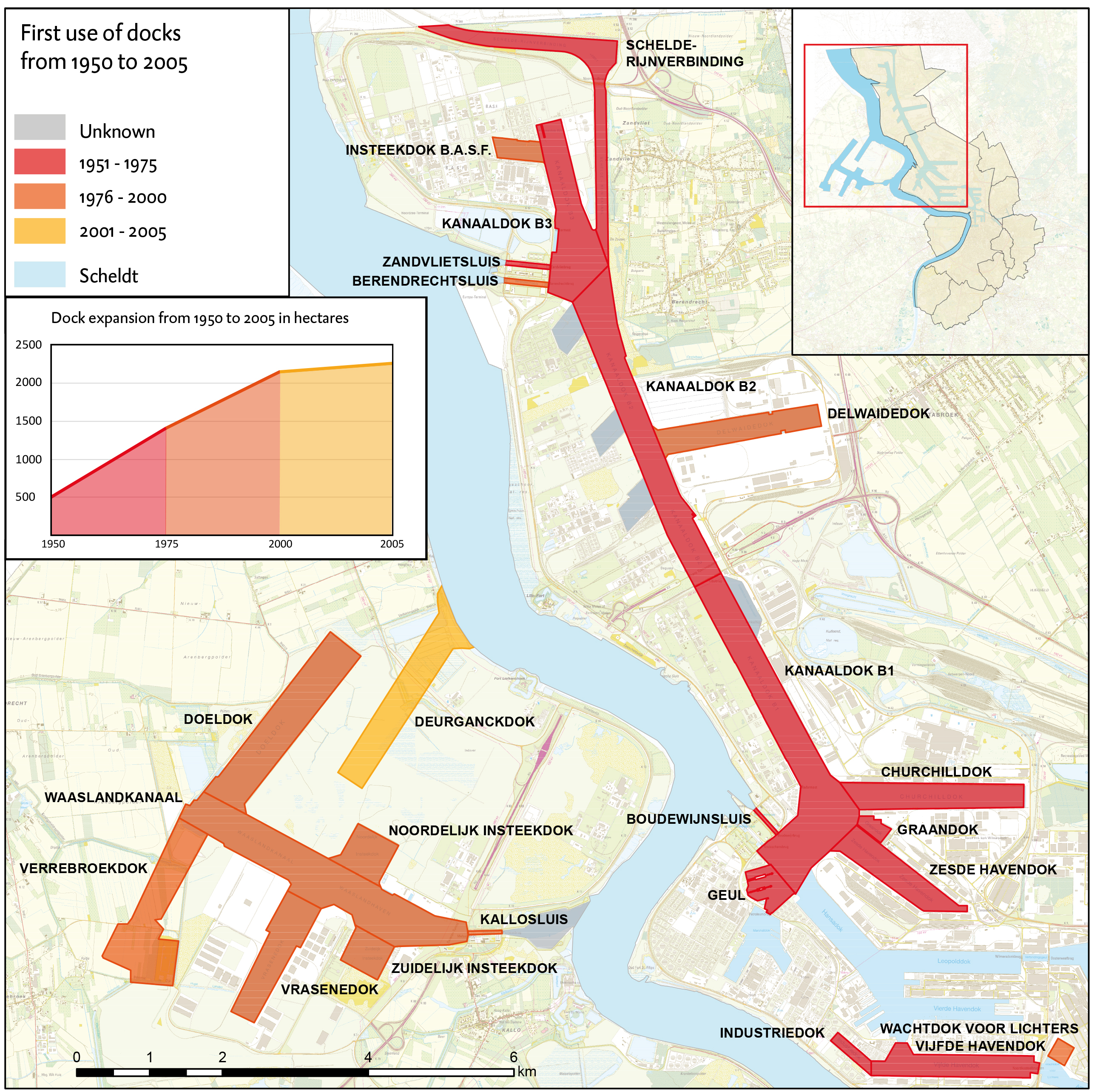
Chapter 34 - expansion of the port’s docks northwards on both sides of the Scheldt between 1950 and 2000